- ALSA Home
- →
- Photo Gallery
- →
- Marion Island
- →
- View Item
JavaScript is disabled for your browser. Some features of this site may not work without it.
| dc.contributor.author | Sub-Antarctic Landscape Climate Interactions | |
| dc.coverage.spatial | Marion Island | en_ZA |
| dc.date.accessioned | 2018-04-20T08:00:40Z | |
| dc.date.available | 2018-04-20T08:00:40Z | |
| dc.date.created | 2016 | en_ZA |
| dc.date.issued | 2016 | |
| dc.identifier.uri | en_ZA | |
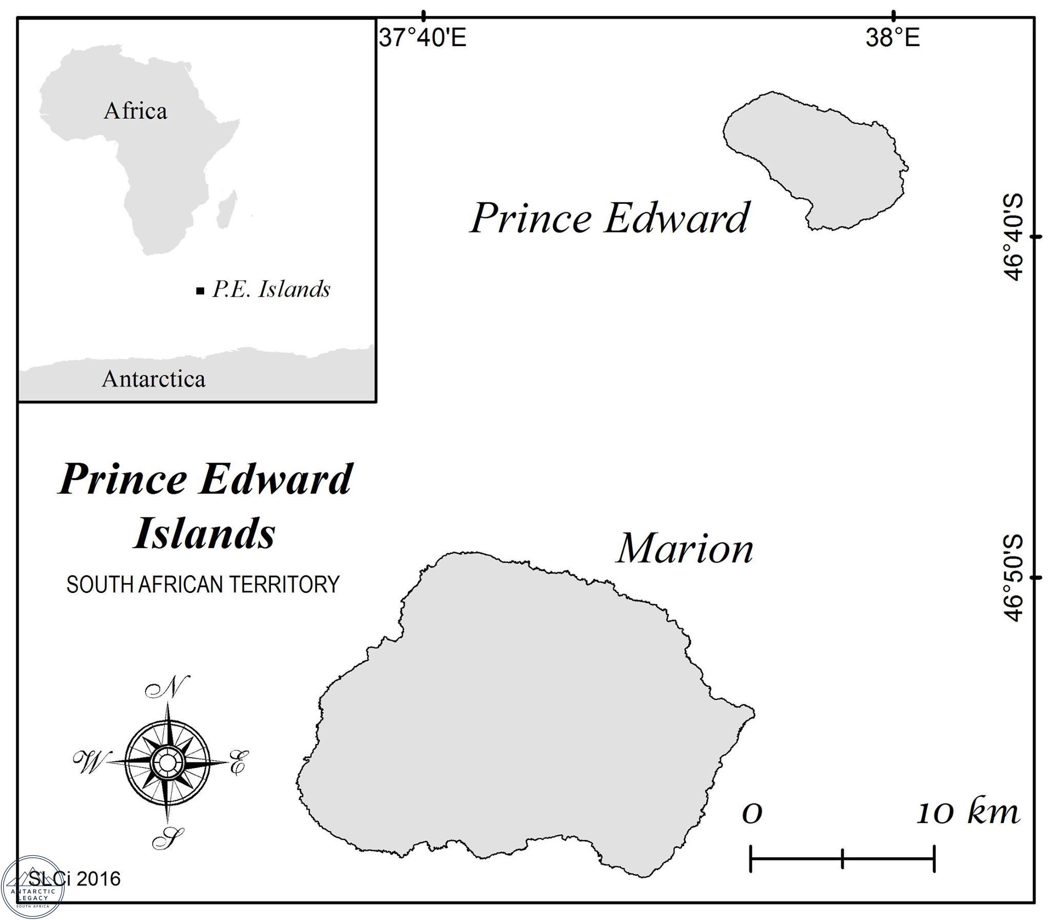
| dc.description.abstract | Map supplied by Geomorphologists researchers of Marion Island - Sub-Antarctic Landscape Climate Interactions group. | en_ZA |
| dc.description.sponsorship | Sponsored by the National Research Foundation (South Africa) | |
| dc.description.statementofresponsibility | Antarctic Legacy of South Africa | |
| dc.description.statementofresponsibility | Image | en_ZA |
| dc.format | http://hdl.handle.net/123456789/4544 | en_ZA |
| dc.language | en_ZA | |
| dc.language.iso | en_ZA | en_ZA |
| dc.rights | copyright | |
| dc.subject | Marion Island | |
| dc.subject | Map indicating the location of the Prince Edward Islands. | en_ZA |
| dc.title | Images | en_ZA |
| dc.type | This item and the content of this website are subject to copyright protection. Reproduction of the content, or any part of it, other than for research, academic or non-commercial use is prohibited without prior consent from the copyright holder. | en_ZA |
| iso19115.mdconstraints.uselimitation | Sub-Antarctic Landscape Climate Interactions | en_ZA |
| iso19115.mdfeaturecataloguedescription.cataloguedate | JPG | |
| iso19115.mdformat.name | Antarctic Legacy of South Africa, Faculty of Science, Private Bag X1, Matieland. Stellenbosch. South Africa. | en_ZA |
| iso19115.mdidentification.deliverypoint | antarcticlegacy@sun.ac.za | en_ZA |
Files in this item
This item appears in the following Collection(s)
-
Marion Island [5621]
Photo Gallery of Images taken on and around Marion Island