- ALSA Home
- →
- Documents
- →
- Official Documents
- →
- View Item
JavaScript is disabled for your browser. Some features of this site may not work without it.
| dc.contributor.author | Martin, Mike | |
| dc.coverage.spatial | Antarctica | |
| dc.date.accessioned | 2015-12-07T07:08:51Z | |
| dc.date.available | 2015-12-07T07:08:51Z | |
| dc.date.created | 1971 | en_ZA |
| dc.date.issued | 1971 | |
| dc.date.issued | 1971 | |
| dc.identifier.uri | http://hdl.handle.net/123456789/2470 | |
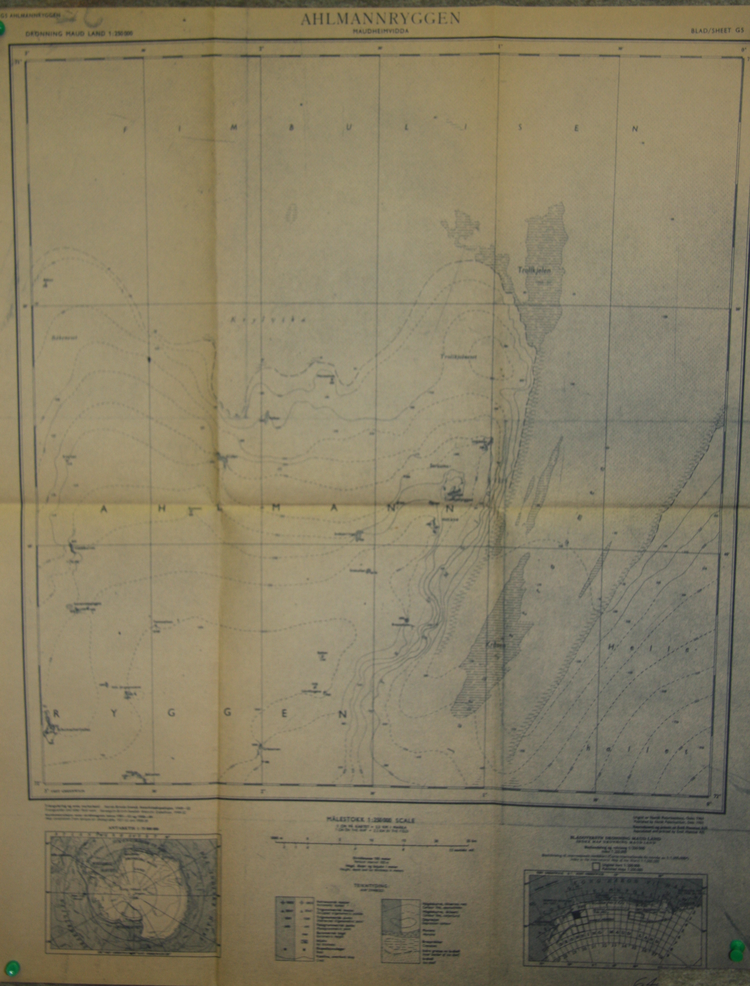
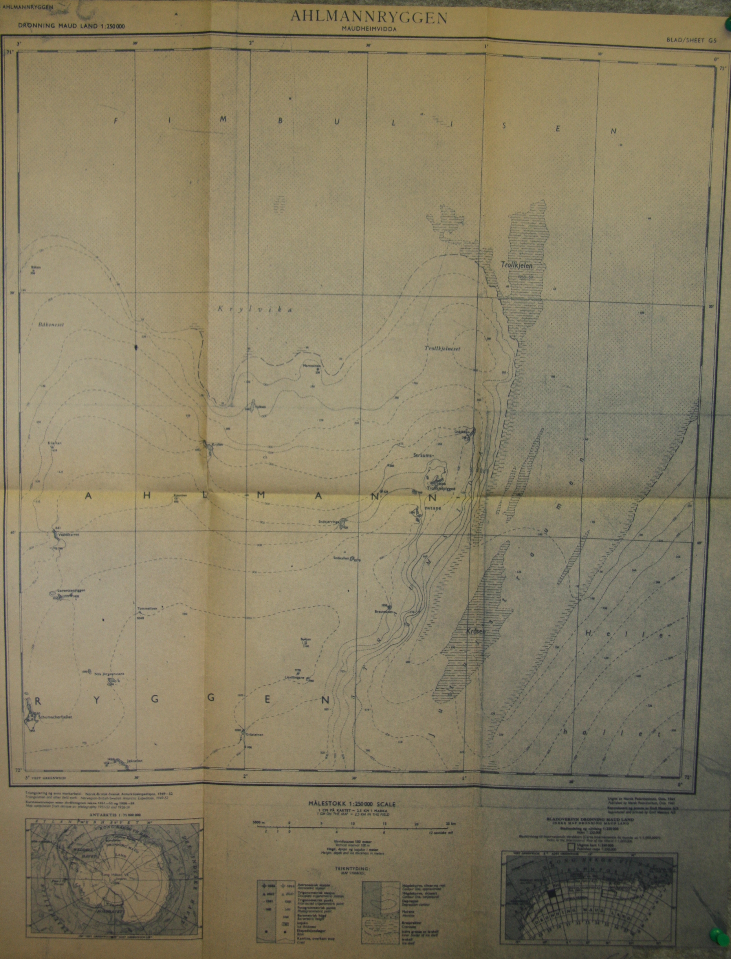
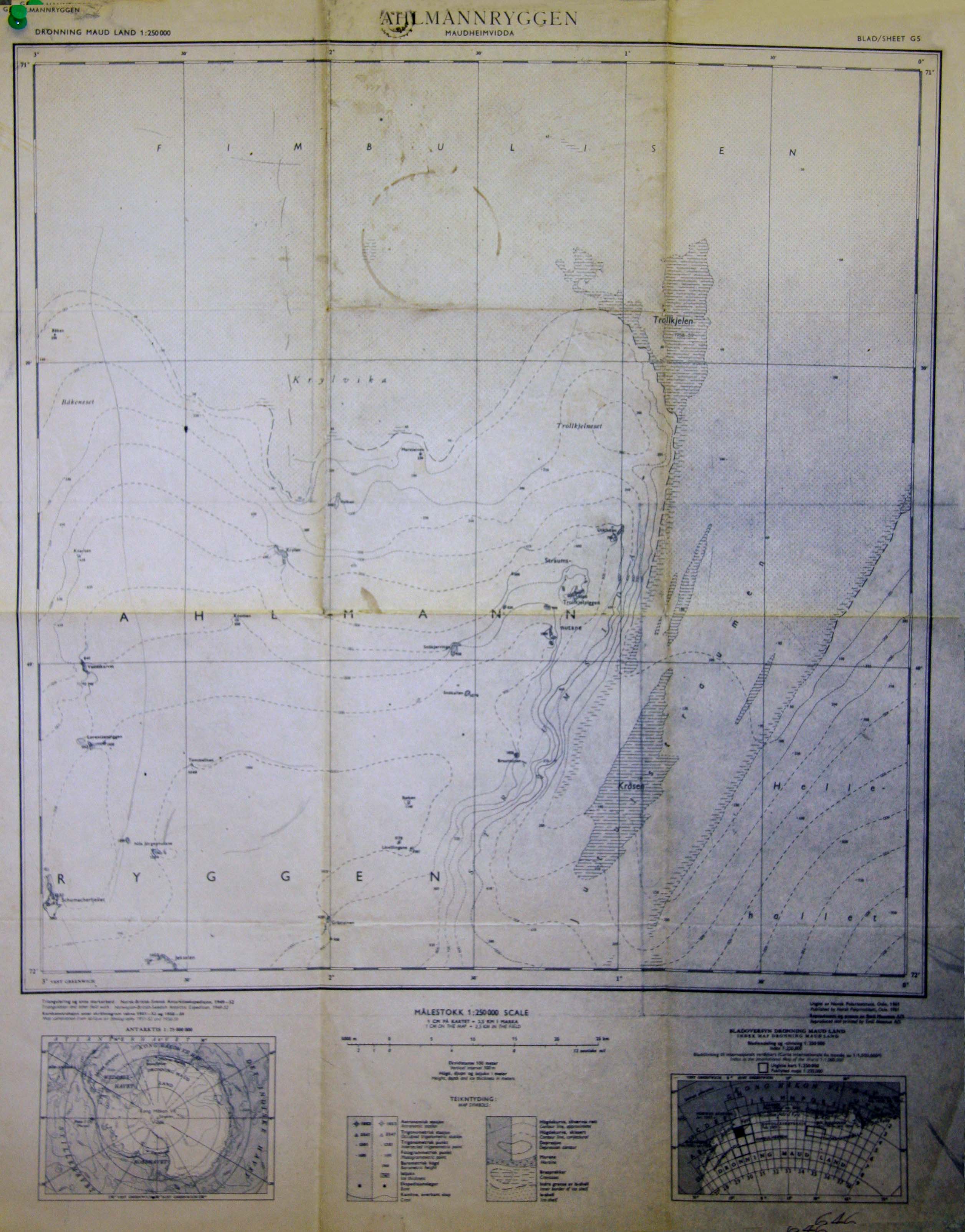
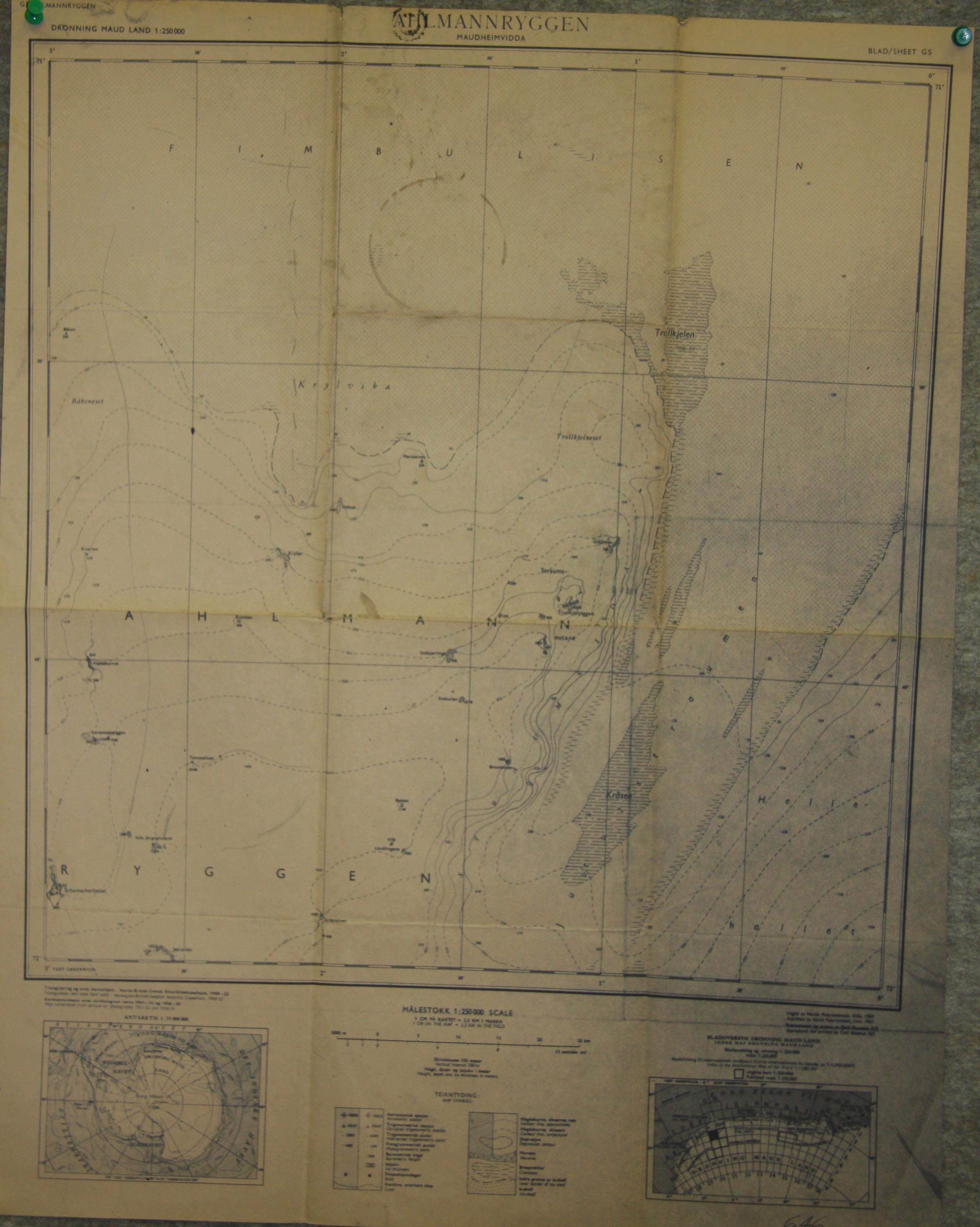
| dc.description.abstract | Norwegian maps of Antarctica, used by Mike Martin and his team during their year at SANAE in 1971. | en_ZA |
| dc.description.sponsorship | Sponsored by the National Research Foundation (South Africa) | en_ZA |
| dc.description.statementofresponsibility | Antarctic Legacy of South Africa | en_ZA |
| dc.language | en_ZA | en_ZA |
| dc.rights | copyright | en_ZA |
| dc.subject | SANAE 12 | en_ZA |
| dc.subject | Antarctica | en_ZA |
| dc.subject | Geology | en_ZA |
| dc.subject | Measurements | en_ZA |
| dc.subject | Norway | en_ZA |
| dc.subject | SANAE | en_ZA |
| dc.title | Ahlmannryggen Map | en_ZA |
| dc.type | Map | en_ZA |
| iso19115.mdconstraints.uselimitation | This item and all the content of this website are subject to copyright protection. Reproduction of the content, or any part of it, other than for research, academic or non-commercial use is prohibited without prior consent from copyright holder. | en_ZA |
| iso19115.mddistributor.distributorcontact | Mike Martin | en_ZA |
| iso19115.mdformat.name | en_ZA | |
| iso19115.mdidentification.deliverypoint | Antarctic Legacy of South Africa, Faculty of Science, Private Bag X1, Matieland. Stellenbosch. South Africa. | en_ZA |
| iso19115.mdidentification.electronicmailaddress | antarcticlegacy@sun.ac.za | en_ZA |
Files in this item
This item appears in the following Collection(s)
-
Official Documents [253]
Official documents compiled within the South African National Antarctic Programme